|
|
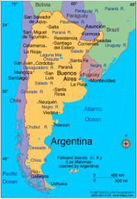
total: 2,780,400 sq km
water: 43,710 sq km
land: 2,736,690 sq km
border countries: Bolivia, Brazil, Chile, Paraguay, Uruguay
total distance of all land boundaries: 11,968 km
coastline distance: 4,989 km
climate: mostly temperate; arid in southeast; sub-antarctic in southwest
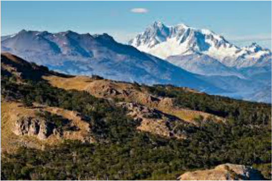
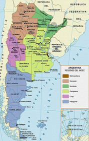
terrain: rich plains of the Pampas in northern half, flat to rolling plateau of Patagonia in south, rugged Andes along western border.
lowest point: Laguna del Carbon -105 m (located between Puerto San Julian and Comandante Luis Piedra Buena in the province of Santa Cruz)
highest point: Cerro Aconcagua 6,960 m (located in the northwestern corner of the province of Mendoza; highest point in South America)
water: 43,710 sq km
land: 2,736,690 sq km
border countries: Bolivia, Brazil, Chile, Paraguay, Uruguay
total distance of all land boundaries: 11,968 km
coastline distance: 4,989 km
climate: mostly temperate; arid in southeast; sub-antarctic in southwest
terrain: rich plains of the Pampas in northern half, flat to rolling plateau of Patagonia in south, rugged Andes along western border.
lowest point: Laguna del Carbon -105 m (located between Puerto San Julian and Comandante Luis Piedra Buena in the province of Santa Cruz)
highest point: Cerro Aconcagua 6,960 m (located in the northwestern corner of the province of Mendoza; highest point in South America)