|
|
|
total: 26,338 sq km
land: 24,668 sq km
water: 1,670 sq km
size compared to the U.S: slightly smaller than Maryland
total land boundaries: 893 km
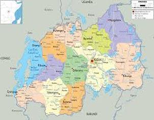
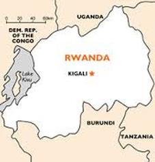
border countries: Burundi, Democratic Republic of the Congo, Tanzania, Uganda
coastline: landlocked
climate: temperate; two rainy seasons (February to April, November to January); mild in mountains with frost and snow possible.
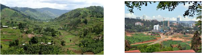
terrain: mostly grassy uplands and hills; relief is mountainous with altitude declining from west to east.
lowest point: Rusizi River 950 m
highest point: Volcan Karisimbi 4,519 m
land: 24,668 sq km
water: 1,670 sq km
size compared to the U.S: slightly smaller than Maryland
total land boundaries: 893 km
border countries: Burundi, Democratic Republic of the Congo, Tanzania, Uganda
coastline: landlocked
climate: temperate; two rainy seasons (February to April, November to January); mild in mountains with frost and snow possible.
terrain: mostly grassy uplands and hills; relief is mountainous with altitude declining from west to east.
lowest point: Rusizi River 950 m
highest point: Volcan Karisimbi 4,519 m